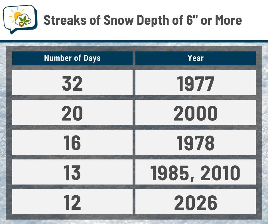
The streak of having at least 6” of snow on the ground ended on Friday at 12 days. Only five instances have been longer.
Also! Sunset on Monday is at 6:00 p.m., the first time since November 1 (the day before daylight saving time ended). And from March 7 to March 8 — less than a month away — it’ll jump from 6:30 p.m. to 7:31 p.m. when daylight saving time returns.
The 614cast
Monday’s tl;dr
⛅ Partly cloudy, high in the lower 30s.

Forecast highlights
🫠 Having a meltdown
We’ve endured a long stretch of cold temperatures. Check out this calendar of high temperature departures this year. We’ve been below average nearly every day for almost a month, and by quite a bit on many days.
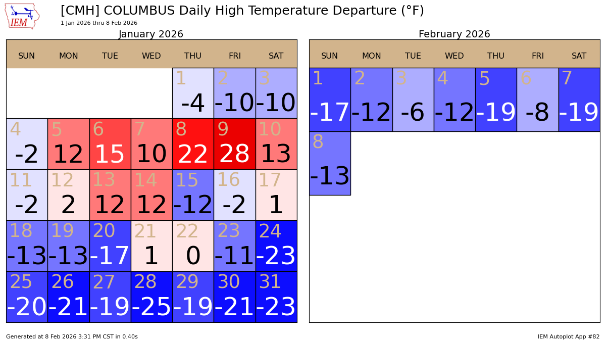
This week will be our warmest in approximately forever. And Tuesday’s high should eclipse the 40-degree mark! That means our sub-40° streak will end at 26 days, the longest since 2021 (also 26 days).
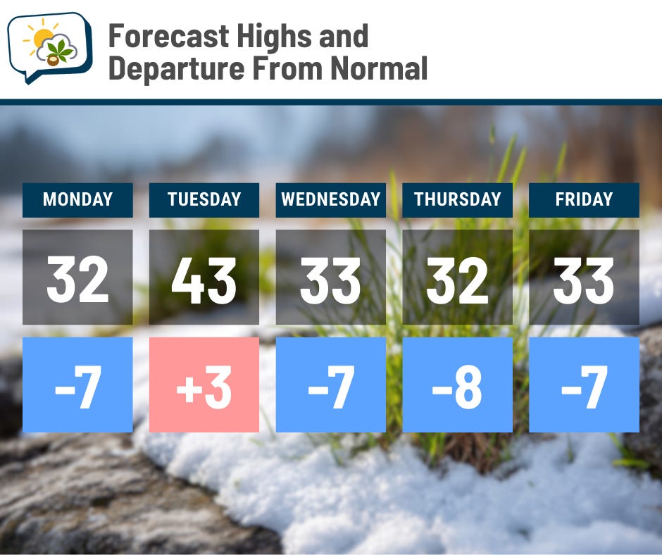
Even though most of the workweek will still be cooler than average, we should top out near or above freezing each day. And as you may have noticed, even the cold days have had some appreciable melting when the sun is out. We’ll definitely see snow and ice get whittled away this week, slowly but surely. I look forward to this, but not our dog’s paws and belly getting very wet every time he goes out (#corgilife).
Watch out for stuff refreezing, especially on sidewalks and in parking lots.
Looking a ways out in the future, the Climate Prediction Center believes the odds favor above-average temperatures after this upcoming week.
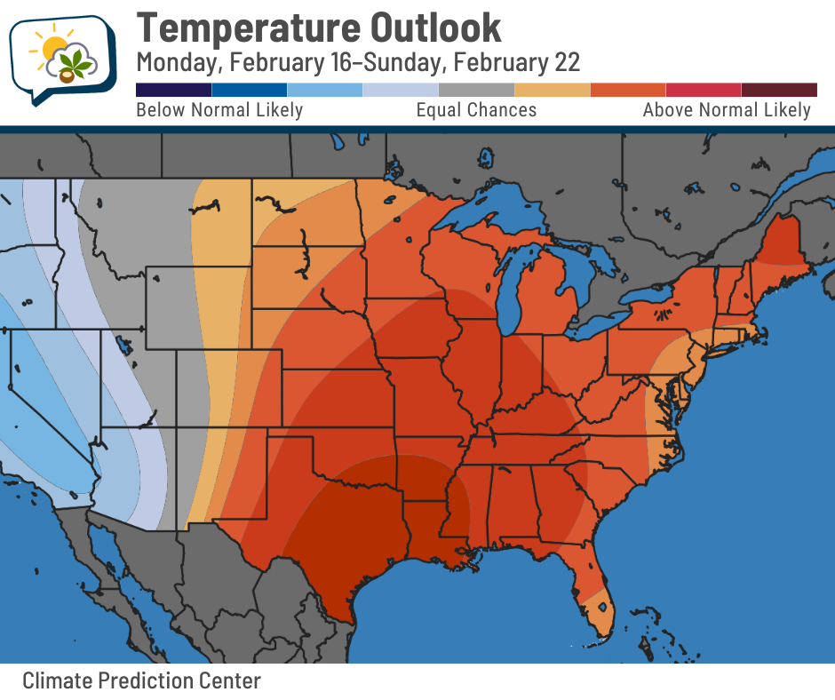
That’s not a guarantee, but at least it’s a glimmer of hope. And though I’m not seeing signs of sustained warm periods (like, all 40s and 50s) showing up just yet… but no sustained cold ones, either.
💤 Not much action until the weekend — maybe
The nice warmup Tuesday comes ahead of a little Canadian disturbance, but it doesn’t look to do much of anything to us other than influence our temperatures.
Here’s a forecast weather map from the AI version of the European forecast model. The week ahead is pretty quiet in our neck of the woods until perhaps this weekend.
This, along with other guidance, shows a system somewhere to our south then. However, the details remain hazy about what might we get. It’s possible that, if it does bring us precipitation, rain could be involved, rather than just snow.
With a lack of notable weather systems, this doesn’t look like a very windy week. Wednesday could be a bit blustery as gusts over 20 mph are possible, but they won’t cause bitterly cold wind chills.
📊 Monday’s almanac
Normal low/high: 23 / 39
Record low/high: -17 (1899) / 72 (2023)
Sunrise/set: 7:31 a.m. / 6:00 p.m.
🌞 Solar seasons
Last week, I saw some posts from meteorologists about the first day of “solar spring.” I didn’t recall being familiar with solar seasons, but I really like the concept.
As you might have guessed, solar seasons make up four chunks of the year. Solar winter is the three months with the least amount of daylight; solar summer is the three months with the most amount of daylight. Solar spring and fall, of course, are the seasons in between.
Since the least amount of daylight happens on the winter solstice, solar winter runs from about 45 days beforehand to 45 days afterward. That’s early November to early February.
Solar spring runs until early May. Between now and then, we’ll gain more than three-and-a-half hours of daylight. 🥳
🌭 For the weather weenies
-
Scientists solve mystery of how Earth’s greenhouse age ended (University of Southampton)
-
Weather influencers are going viral. How much should we trust them? (NPR)
-
Climate change in the American mind: Beliefs & attitudes, fall 2025 (Yale Program on Climate Change Communication)