Short newsletter this time… played Stardew Valley with the kid this evening. 🧑🌾
The 614cast
Thursday’s tl;dr
🌤️ Clouds early then turning sunny, high in the mid-40s. Much lighter wind.
Forecast highlights
😵💫 Topsy-turvy temperatures
While Thursday will be a bit cooler than Wednesday was, the wind will be so much lighter. Considering that and having a lot of sunshine in the afternoon, the mid-40s will feel pretty nice.
We’re in the 50s Friday and Saturday. It’ll be a tad breezy on Friday, but not too bad. We’ll have a setback for a couple of days before warmer air punches back in. It appears a good share of next week and beyond should feature warmer than average temperatures. So, after dipping into the 30s Sunday and Monday, readings steadily climb into the 40s and probably 50s as the week goes on.
🏃 Pattern turns more active
That early-Thursday system that I talked about in my last newsletter all but completely passes to our south. Funny how that worked out…
Next up is a weak disturbance Saturday night, followed by a more systems next week.
Precipitation type for the first one or two is not obvious. There are signs that whatever comes through Sunday night into Monday could bring accumulating snow. But after that, we get warm enough again for just rain for the following ones.
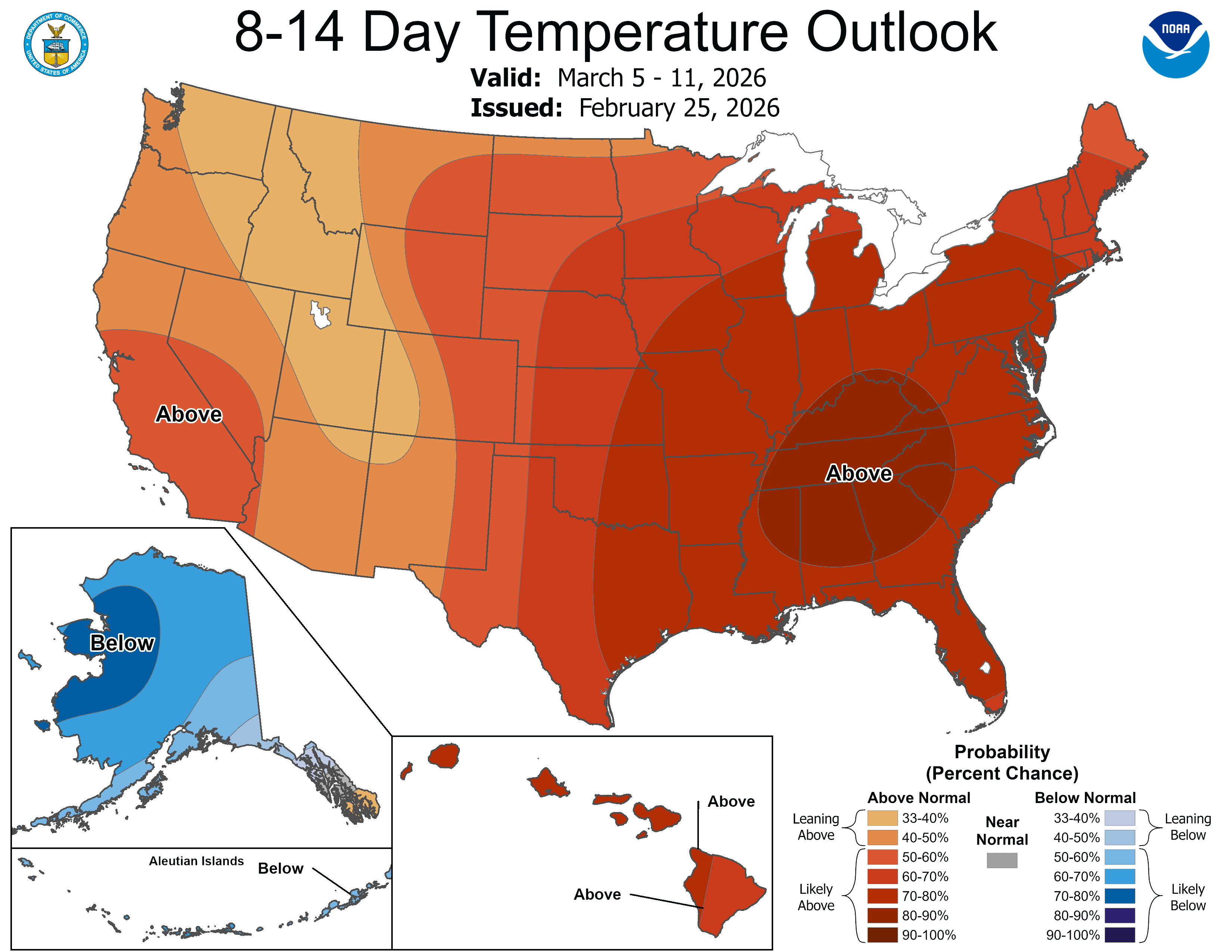
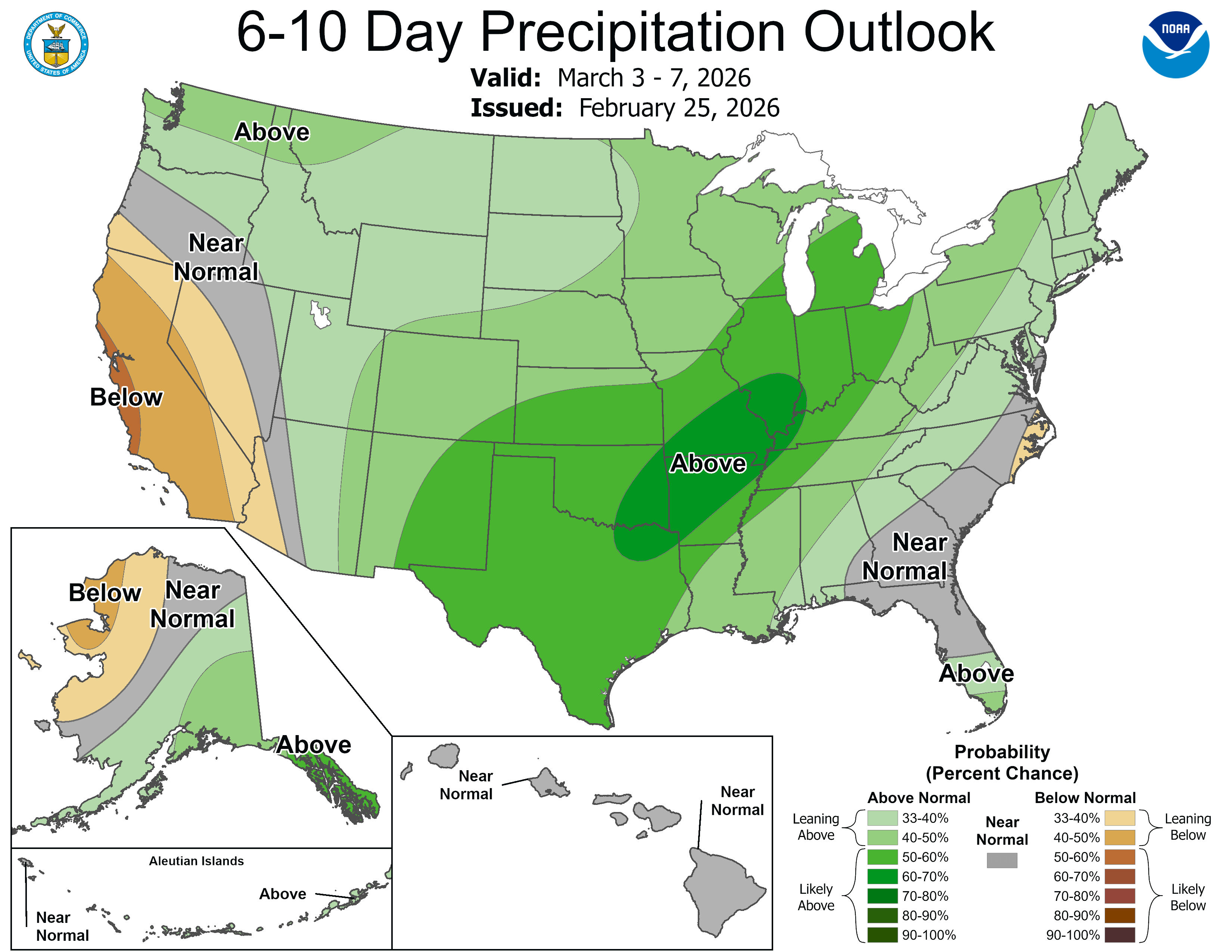
The Climate Prediction Center shows pretty good odds of next week being wetter than average.
📊 Thursday’s almanac
Normal low/high: 27 / 44
Record low/high: -10 (1963) / 75 (2000)
Sunrise/set: 7:09 a.m. / 6:20 p.m.
⚡ First severe weather warnings
It’s been nearly a week since thunderstorms rolled across the state, prompting severe thunderstorm warnings and even a few tornado warnings.
This plot shows the period between the first and last severe thunderstorm warnings of the year in Ohio, going back to 1986.

You can see the full-size version of the plot here.
It turns out the average date of the first such warning is February 14, so we were just a bit behind average this year. Of course, there’s typically not much activity between the first date and further into spring. Then things really pick up, with the most active days happening running from late spring and into the summer.
The average last date is November 19. We’ll see what this year brings!
🌭 For the weather weenies
-
Taking a deep dive into Blizzard 2026 (BalancedWx)
-
Ghostly UV sparks light up forests as thunderstorms pass overhead (Scientific American)
-
‘Groundbreaking’ model can calculate true impact of climate change and it’s bad news for Europe (euronews)