⚠️ A flood watch is in effect through midday Thursday. Streams and ditches may become full or spill out of their banks, and street flooding is possible in the usual trouble spots.
Also… Monday sure was dumb.
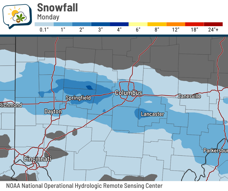
We’ve entered the time of year when snowfall rates can go bonkers for a couple of hours and really mess things up. It certainly didn’t help that the snow band set up farther north than originally anticipated. Some spots in the metro picked up 2–3”, which demonstrated that, even if something is improbable, it’s still possible.
On to the rain and warmth…
The 614cast
Thursday’s tl;dr
🌧️ Occasional rain with patchy morning fog, high in the mid-60s.

Forecast highlights
⛓️💥 Wet, a break, then maybe wet again
Passing downpours come through Wednesday night, followed by occasional rounds of rain Thursday. Rain should be more sparse on Friday before picking up again Saturday.
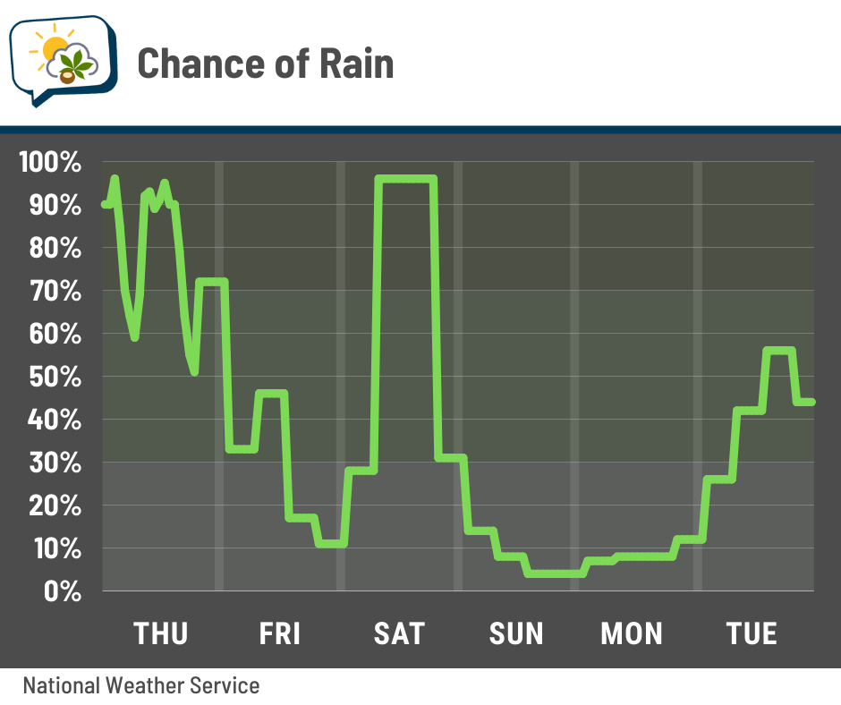
We’ll have some humid-ish weather over the next few days until a cold front sweeps through later Saturday. That’ll take away the relative mugginess, as well as our rain chances, for at least a couple of days. Activity may pick up again toward the middle of next week.
Through Saturday evening, we’re in line to probably pick up roughly a couple more inches of rain. Thunder should accompany some of our bouts of rain, but strong to severe storms are unlikely. If they happen, they would bring gusty winds or small hail .
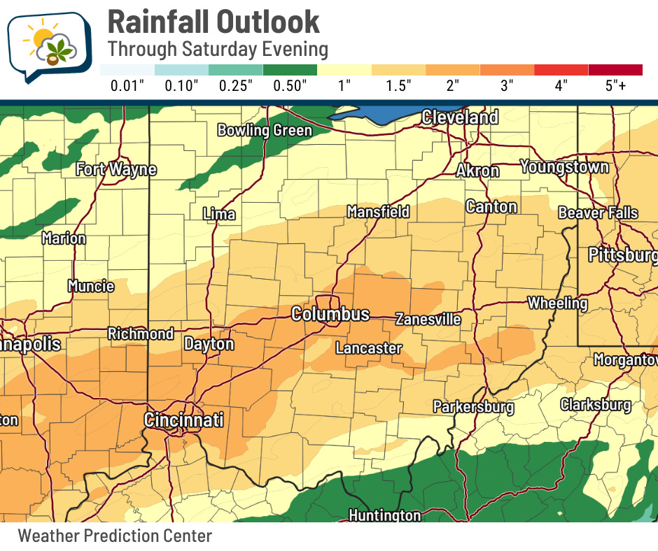
CMH has picked up just over an inch so far this week, as of Wednesday evening.
🗓️ Not feeling like early March
Upcoming temperatures will be more typical of late April.
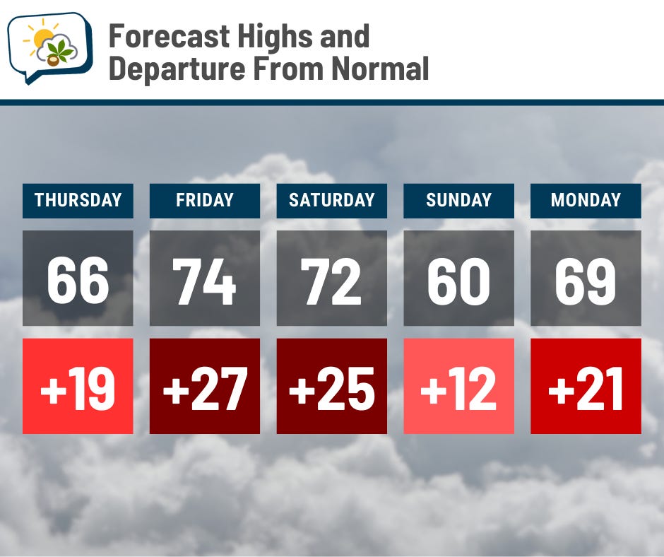
The coolest day of the next several is Sunday, and that 60° high is still a fair bit above average!
Saturday looks like the breeziest day with gusts peaking around 25 mph… but it looks like it’ll be a wet day, so it’s not like many of us will be wanting to spend a lot of time outside, anyway. But if you do and you have an umbrella, plan on having to fight the wind.
Many locations will approach or set record warm highs and/or lows at least one day between Thursday and Saturday.
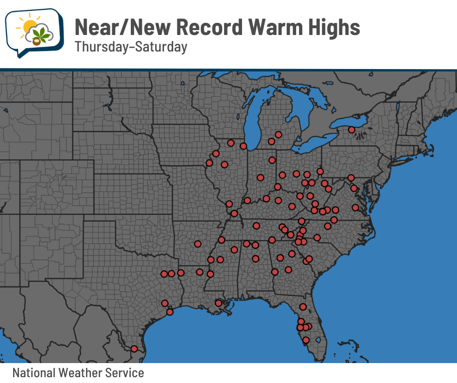
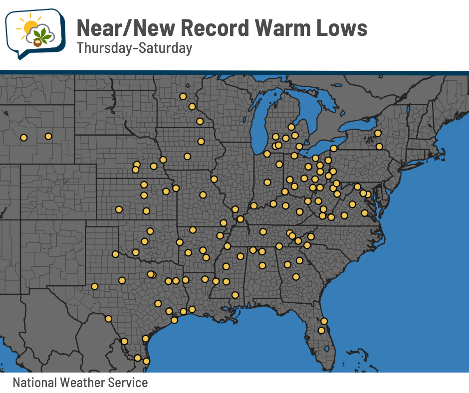
On Friday, we’ll be pretty close to the record high of 76°. Record warm lows are also in jeopardy the next few nights.
📊 Thursday’s almanac
Normal low/high: 29 / 47
Record low/high: 1 (1978) / 78 (1983)
Sunrise/set: 6:59 a.m. / 6:28 p.m.
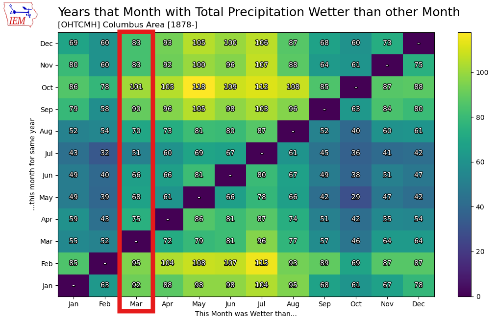
💧 Wettest Marches
March’s average precipitation (rain+melted snow) is 3.62”. We’re on a quick upswing from the average driest month — February, at 2.41” — to the average wettest month — July, at 4.67”.
This can certainly be a very soggy month, though. The wettest March on record was in 1964, when 9.59” fell. 2020 is in second place at 8.16”, while 1913 rounds out the podium with 8.09”. (Only four Marches tallied less than an inch.)
Sometimes, March is wetter than the summer months. March precipitation beat the July precipitation 51 times since 1878, or just over one-third of years.
🌭 For the weather weenies
-
NOAA’s Storm Prediction Center debuts revamp to severe weather outlooks this season (FOX Weather)
-
100th storm name retired after 2025 hurricane season (Tropical Atlantic Update)