I saw at least one AI-generated image purporting to be an aerial photo of tornado damage in Michigan from the other day. It looked awfully real, but there were signs it was fake — the lake had boats on it and the trees had leaves. Those details weren’t immediately obvious, but it’s a sign of the times we’re entering… 🫠
The 614cast
Monday’s tl;dr
☀️ Mostly sunny and a tad breezy at times, high in the upper 60s.

Forecast highlights
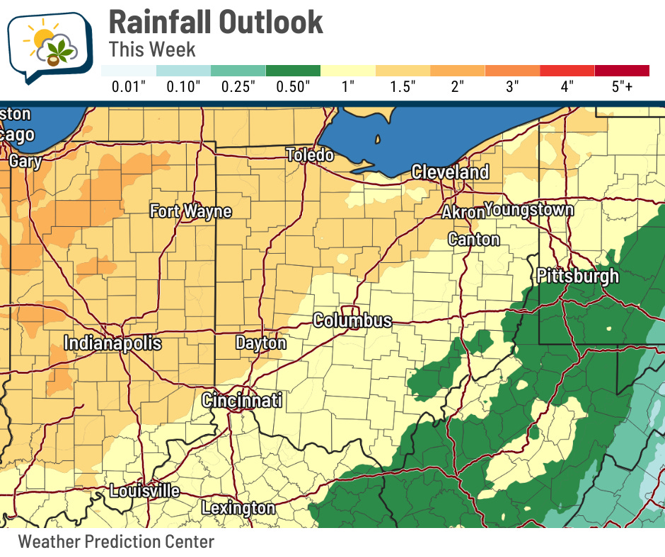
⚡ Rain/storms into midweek
Our weather stays quiet the next couple of days until the next weather system comes through, mainly Tuesday night into Wednesday.
The main focus with this is Wednesday evening, when the cold front brings a chance of strong to severe storms. Just like Sunday, the focus looks like it’ll be roughly along and south/east of I-71.
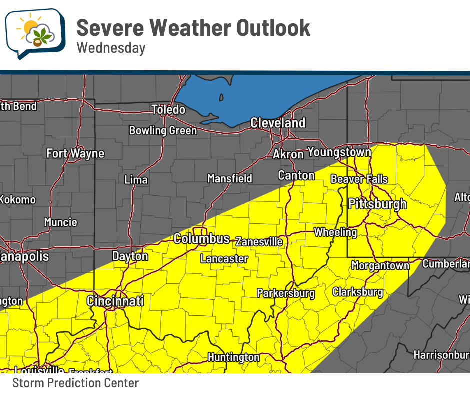
Generally, the ingredients for active storms ought to be in place. However, the coverage and intensity of this late-day round will probably depend partly on how much the earlier round clears out. If it’s showery straight into the afternoon, then we may have trouble getting enough energy for strong storms.
If they do get rambunctious, gusty winds and hail would be the main things to watch for. Winds won’t turn much with height, so the twisting necessary for tornadoes is lacking. If one were to develop, it’d be weak and short-lived, based on current data.
The window for strong storms looks like it’ll be somewhere in the 5–8 p.m. period in the Columbus area.
There’s plenty of moisture around, too, so rainfall amounts could top an inch.
🌡️ Few more mild days, then reality returns
Enjoy the springlike weather while we have it. The cold front that brings the rain and storms makes the bottom drop out in the temperature department.
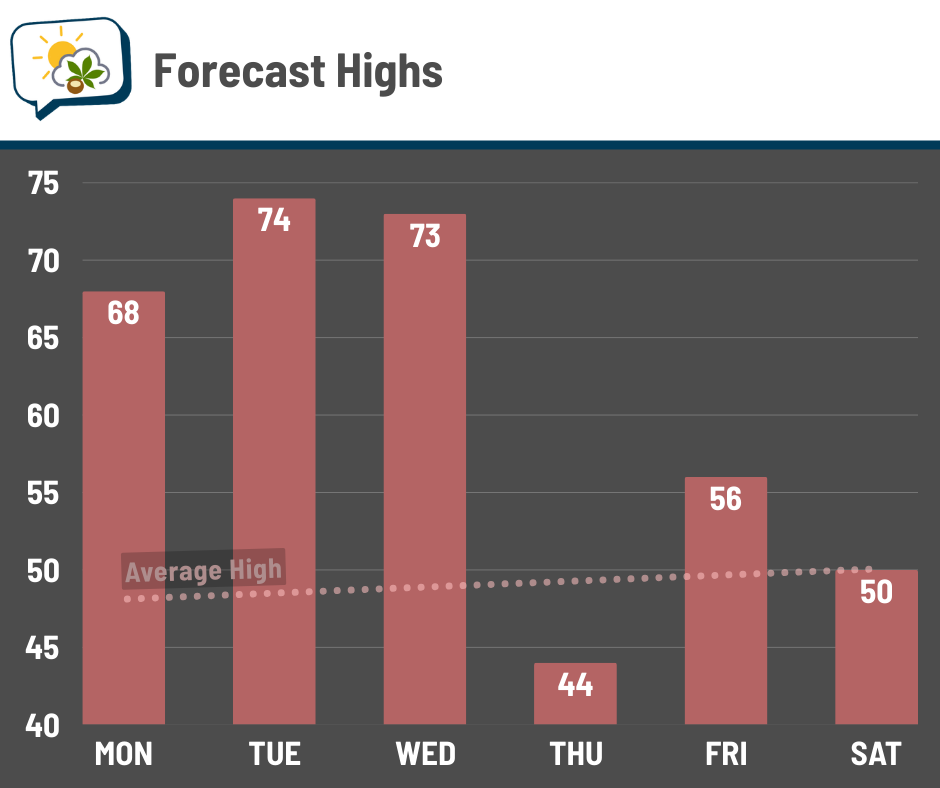
Wednesday will be the breeziest day of the week with gusts topping 30 mph.
📊 Monday’s almanac
Normal low/high: 30 / 48
Record low/high: -6 (1984) / 77 (1974)
Sunrise/set: 7:52 a.m. / 7:32 p.m.
🌅 Making up the morning sun
I like the later sunsets, although losing the morning daylight is a bit of a bummer. It won’t take long for us to make up that lost light, though.
Sunrise Saturday morning was 6:55 a.m. We’re back closer to 8 a.m. for now, but on April 14, sunrise will be back to 6:55 a.m. It’ll keep getting earlier until mid-June, when it reaches its earliest time of 6:02 a.m.
🌭 For the weather weenies
-
NWS: Union City tornado most deadly in Michigan since 1980, rated EF-3 with 150 mph winds (WZZM)
-
New bill would create a board to investigate weather disasters akin to the NTSB (NBC News)