I wanted to punch out this quick update about Wednesday’s storms since some of the details have changed since my newsletter on Sunday.
The “what”
Off the top, here’s the outlook from the Storm Prediction Center (SPC) as of early Tuesday afternoon.
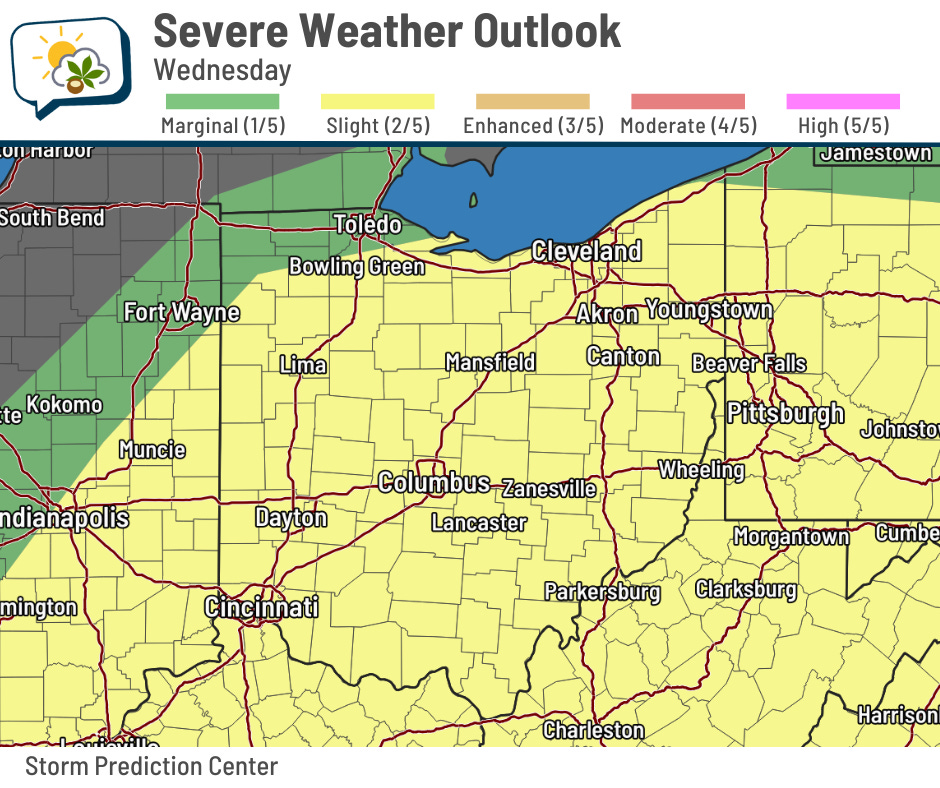
Nearly all the state is in a slight risk, or level 2/5. SPC mentioned in their technical discussion that they will consider possibly doing a higher risk category if there is less storm coverage in the morning and temperatures can warm a little further as a result.
Forecast soundings — basically, a weather model plot of what a weather balloon might show — are more favorable for strong winds than tornadoes. However, small-scale interactions around storms could produce localized winds that turn more near the surface.
The breakout of severe weather hazards from the SPC bear this out:
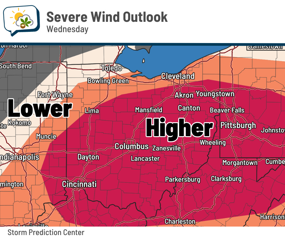
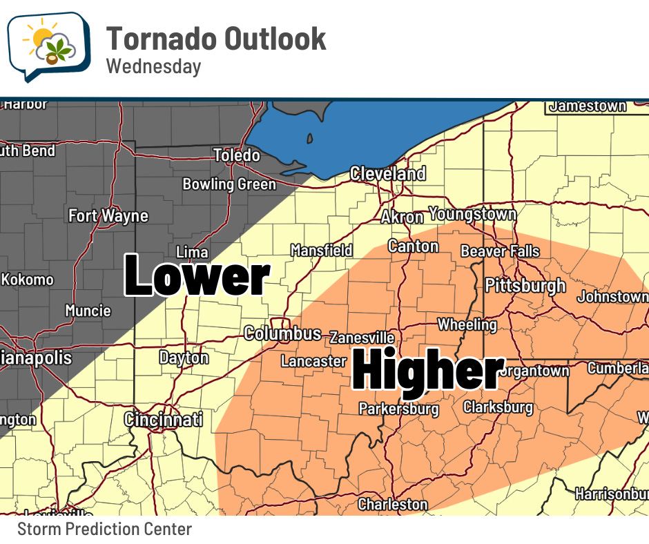
While hail is possible, it’s not one of the main threats.
The “when”
This part is… uh, tricky. As far as when the threat ends, the cold front should be through the Columbus metro by about 7 p.m. Wednesday, ending the risk of severe storms here as the activity heads east.
But there’s energy for storms around throughout the entire day before then. This video shows the storm energy and wind flow from one of the high-resolution forecast models.
Forecast guidance generally has scattered storms around in the morning for the first round (mainly before 10 a.m., perhaps), followed by a late-afternoon round ahead of the cold front (after 3 p.m.). However, how widespread and robust that second round is will really depend on what happens earlier. If stuff clears out and we get several hours of at least partial sun, then odds for a strong second round are higher than if we stay cloudy/showery that whole time.
Long story short, it’s a bit of a messy forecast tomorrow with a few different scenarios. Stay weather-aware so you’re not surprised if things change quickly.