Normally, the “Plus” section is at the bottom of the newsletter, but I figured this one’s kind of a biggie.
This newsletter moved to a twice-weekly cadence in December when I returned to full-time work, once again supporting the NOAA Weather Program Office. While I didn’t foresee stepping away from that role just a few months after going back, an opportunity to get back into broadcast meteorology came along.
I’m joining 10TV WBNS starting tomorrow.

Once I’m settled in, I’ll typically be on during the 8–9 a.m. hour of their streaming morning show, the noon show, and the 2 p.m. streaming weather show. You can catch them live or recorded in their mobile app, streaming TV app, and on YouTube.
What does that mean for this newsletter? It’ll be going on an indefinite break. But if you enjoy my weather stuff, you can follow me in the above places and on my socials:
Thanks for reading these newsletters! They began as something for me to do after my position was eliminated back in the spring, and they’ve been an enjoyable outlet.
Okay, with that out of the way, let’s talk about what’s coming this week…
The 614cast
Monday’s tl;dr
⛅ Cloudy to start, then some sunshine for the afternoon. Much cooler with a high in the upper 40s.

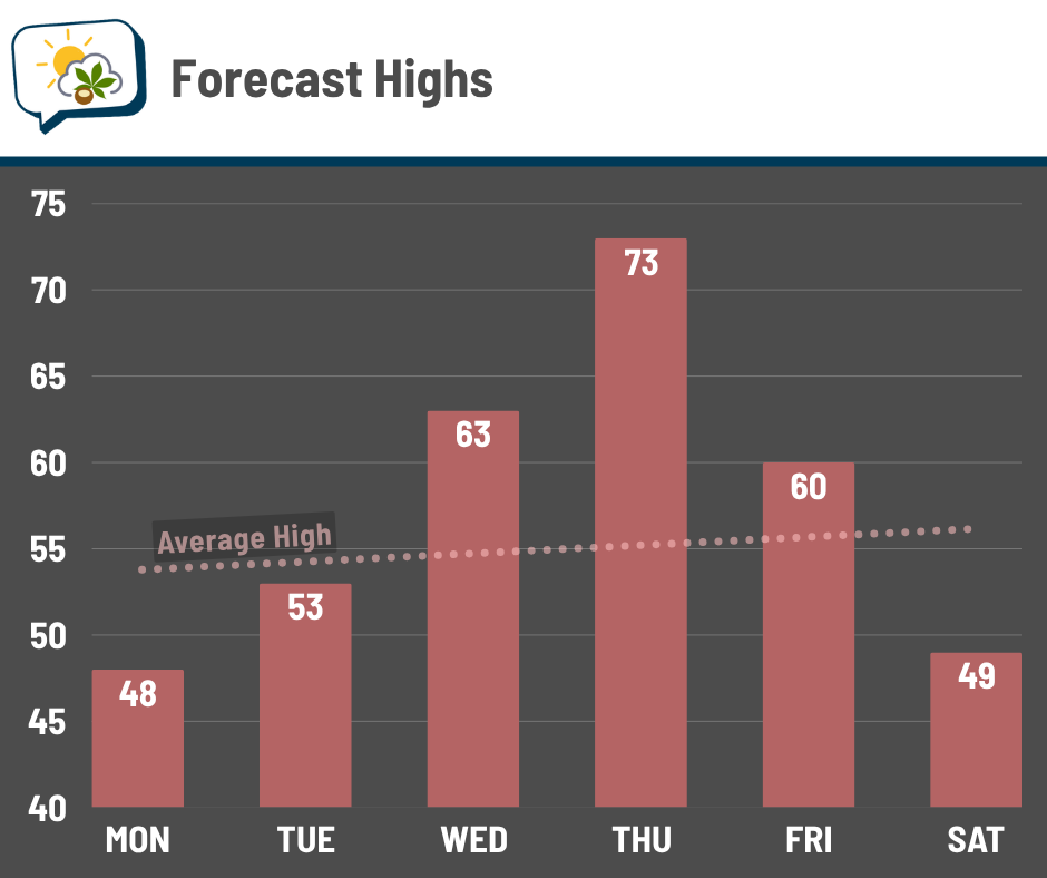
Forecast highlights
🎢 Sharp drop, then a rise, then a drop again
Sunday featured not only a record high for the day, but a record high for all of March. CMH officially logged a high of 86°, besting the record of 85°, set in 2012. 85° was also the monthly record high, which occurred on March 21 and 22, 2012.
When you’re heading out the door Monday morning, temperatures will be in the mid-30s with wind chills in the upper 20s. Yes, it’s going to be 50° colder in the morning than we were Sunday afternoon. That’ll be one of our greatest drops on record:

Thankfully, we’ll climb back up as the week goes on… only to tumble again going into next weekend.
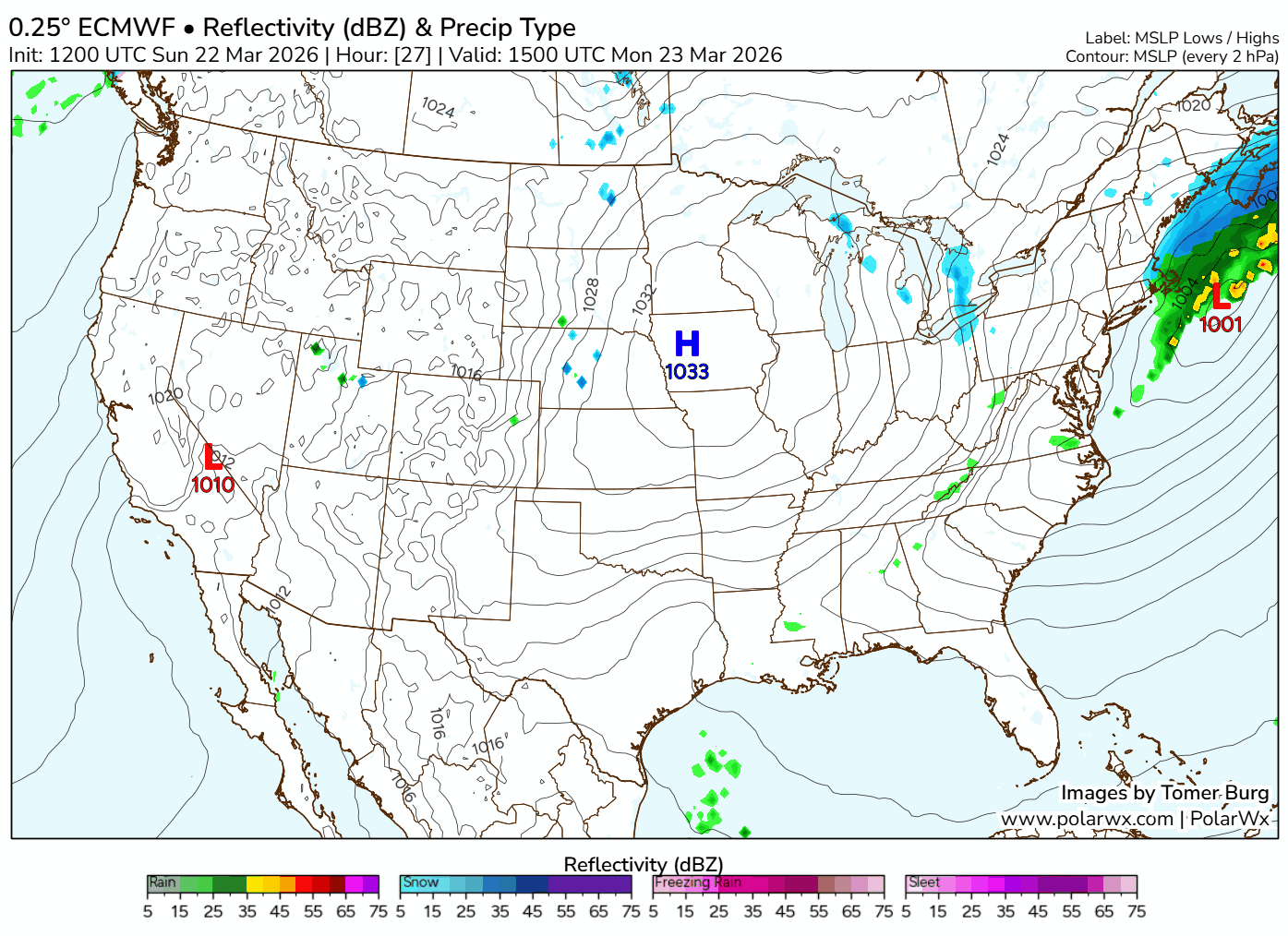
☔ Late-week rain chance
After the round of rain and storms the first part of Sunday night — which could be strong to severe with hail and gusty winds — things dry up for a few days with high pressure controlling our weather. A couple of systems in the Thursday–Friday period bring some rain/storm chances.
📊 Monday’s almanac
Normal low/high: 34 / 54
Record low/high: 9 (1885) / 81 (1907)
Sunrise/set: 7:30 a.m. / 7:47 p.m.
🌭 For the weather weenies
-
Hawaii flooding update: Thousands remain under evacuation orders; dam in danger of failing (The Weather Channel)
-
Over 1,500 records shattered across the Southwest as another week of extreme heat continues (FOX Weather)
-
How does snow gather on a roof? (American Institute of Physics)