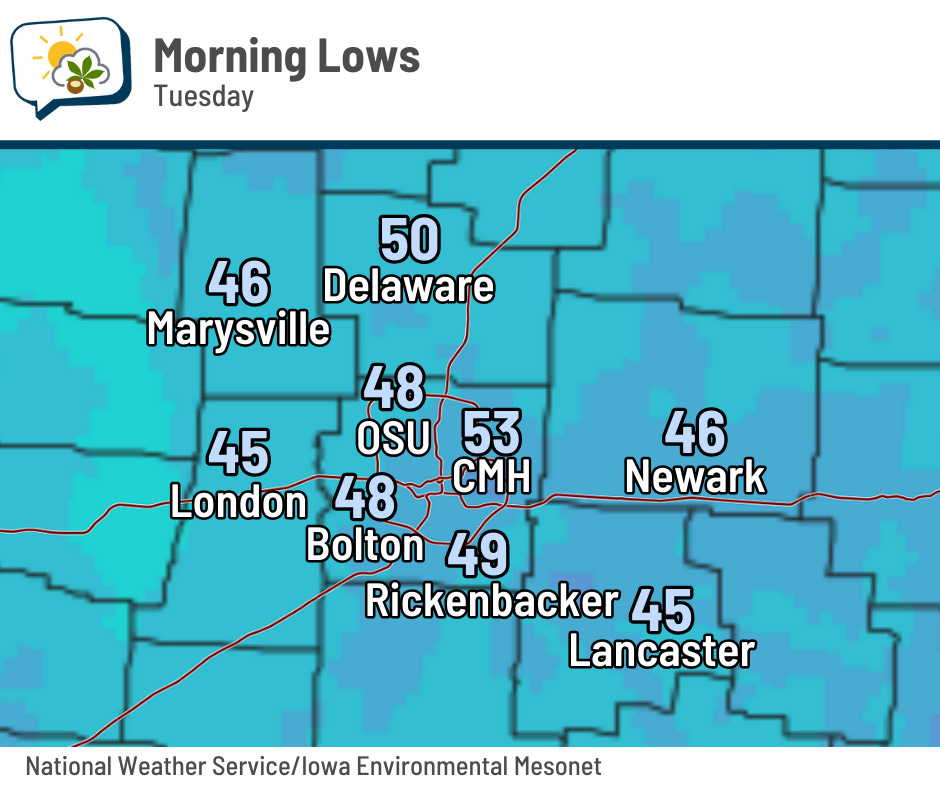
Check out these lows from yesterday morning! Numerous spots dipped into the 40s.
The 614cast
Today’s tl;dr
☀️ Mainly sunny, high in the middle 70s.

Forecast highlights
👍 Pleasant weather rolls on
Yesterday was, dare I say, a little cool! The numbers won’t fluctuate a whole lot over the next several days, coming up a few degrees for midweek before another little dip to finish the week.
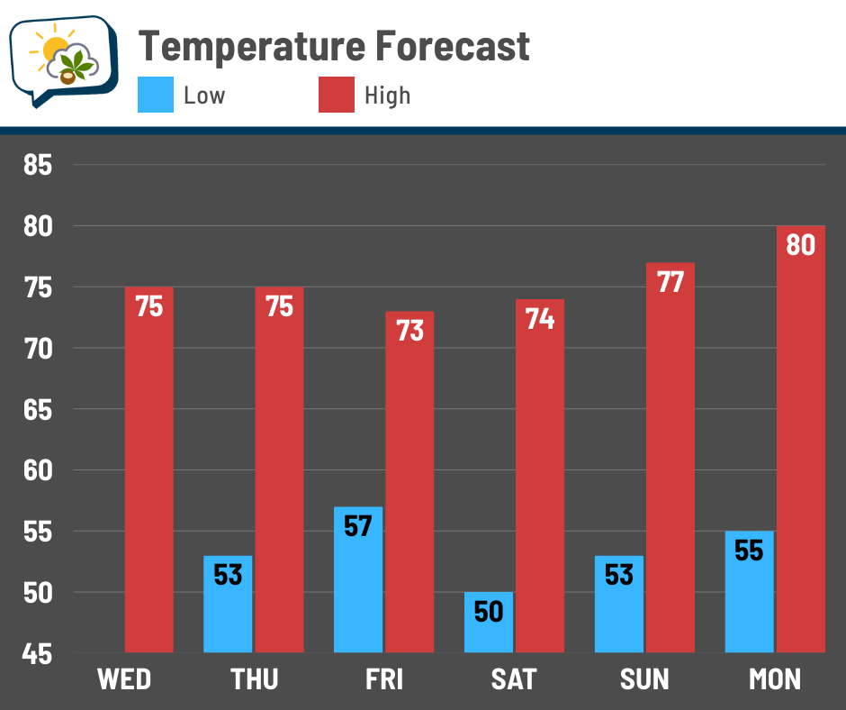
Readings should gradually climb back up to around 80 for Labor Day. It’ll certainly be a comfortable holiday weekend.
🌦️ Shower chance remains low, but not zero
A weak disturbance is still on track to swing across the region Thursday into Thursday night. The odds it’ll produce showers here in central Ohio remain low, but there’s a chance that afternoon and evening nonetheless.
Moisture increases a bit ahead of a cold front (the blue line in the animation below… yeah, it’s rudimentary but I also don’t have the wallet of a TV station for fancypants graphics). The better “forcing” will be to our north, where shower chances are higher.
Whatever might develop locally will be light and more of a brief nuisance than anything consequential.
Winds swing around from the northwest behind the front, drying out our air once again.
📊 Today’s almanac
Normal low/high: 63 / 83
Record low/high: 46 (1968) / 100 (1948)
Sunrise/set: 6:55 a.m. / 8:10 p.m.
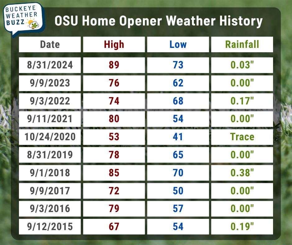
🏈 Buckeye football opener history
Saturday’s the big day for OSU football fans, with a noon kickoff against the Longhorns.
The weather will be absolutely phenomenal. Which got me thinking… what have recent home openers been like? Here are the high, low, and rainfall for each one over the past 10 years, using data from CMH.
🌭 For the weather weenies
-
New AI model shines during Hurricane Erin (Eye on the Tropics)
-
Photos: Monsoon 2025 brings massive dust storm, heavy rain to the Valley (ABC15 Arizona)
-
Haboob slams Phoenix with a towering wall of dust, causing damage, airport delays and power outages (CNN)